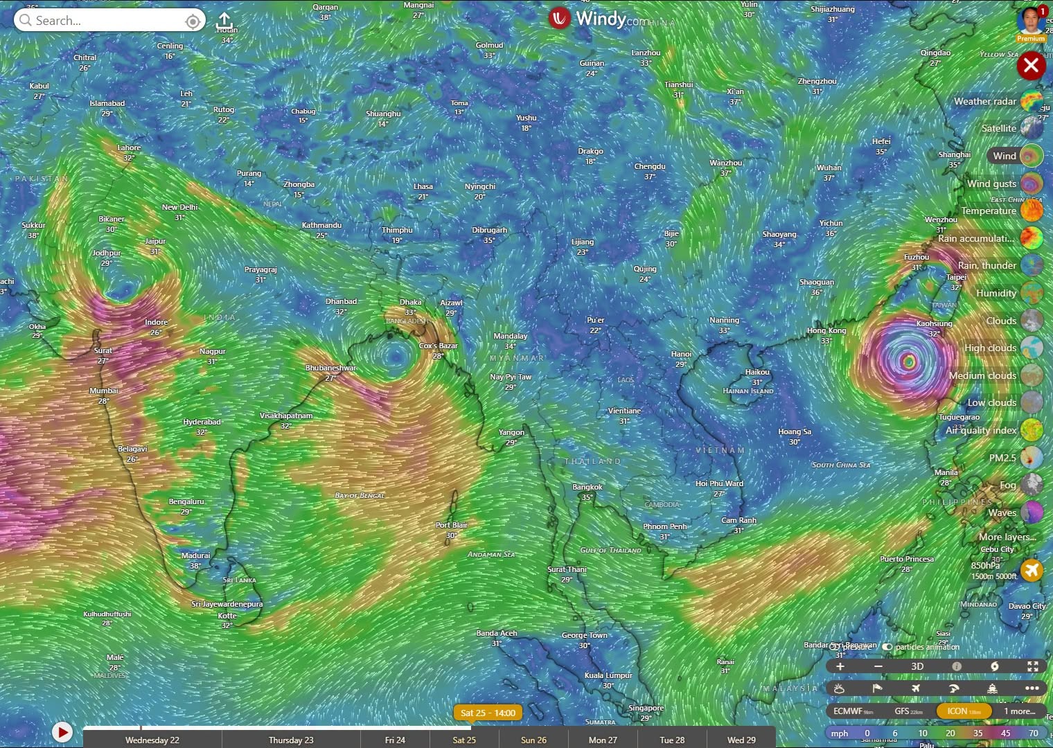
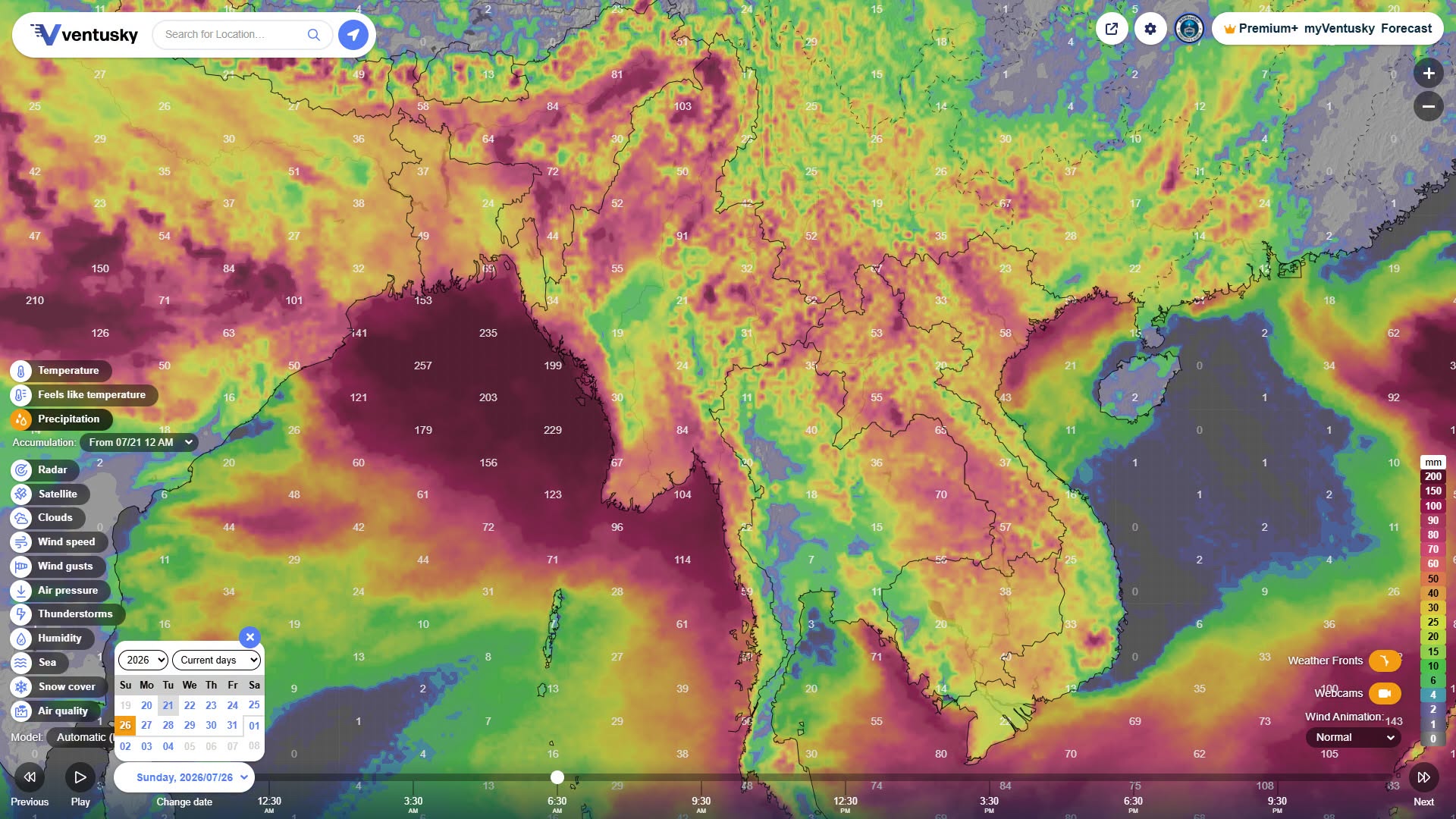
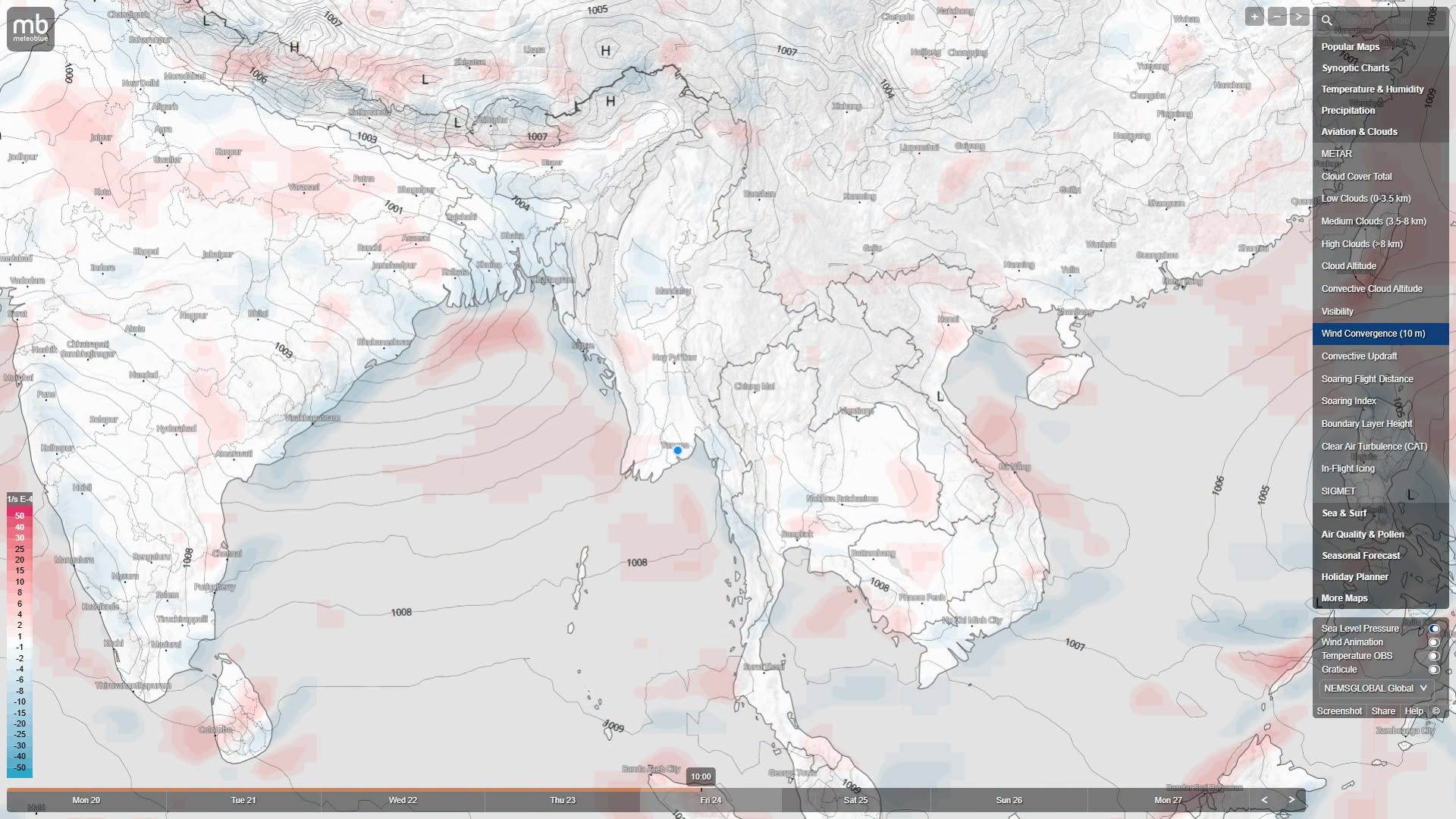
Due to the low pressure area in the Bay of Bengal and the pull of the typhoon, rainfall across Myanmar is expected to significantly increase
July 24
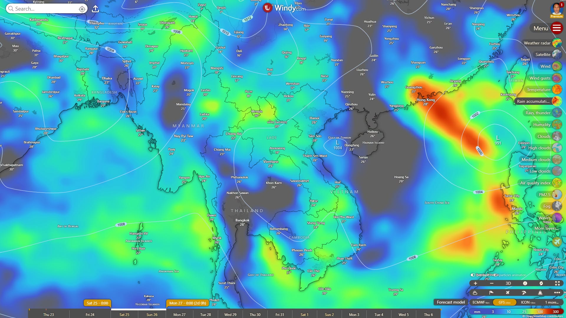
According to forecasts from the ECMWF and ICON models, a strong low pressure area/depression may intensify in the northern Bay of Bengal (off the coast of Bangladesh - Sittwe) between July 25 and 26.
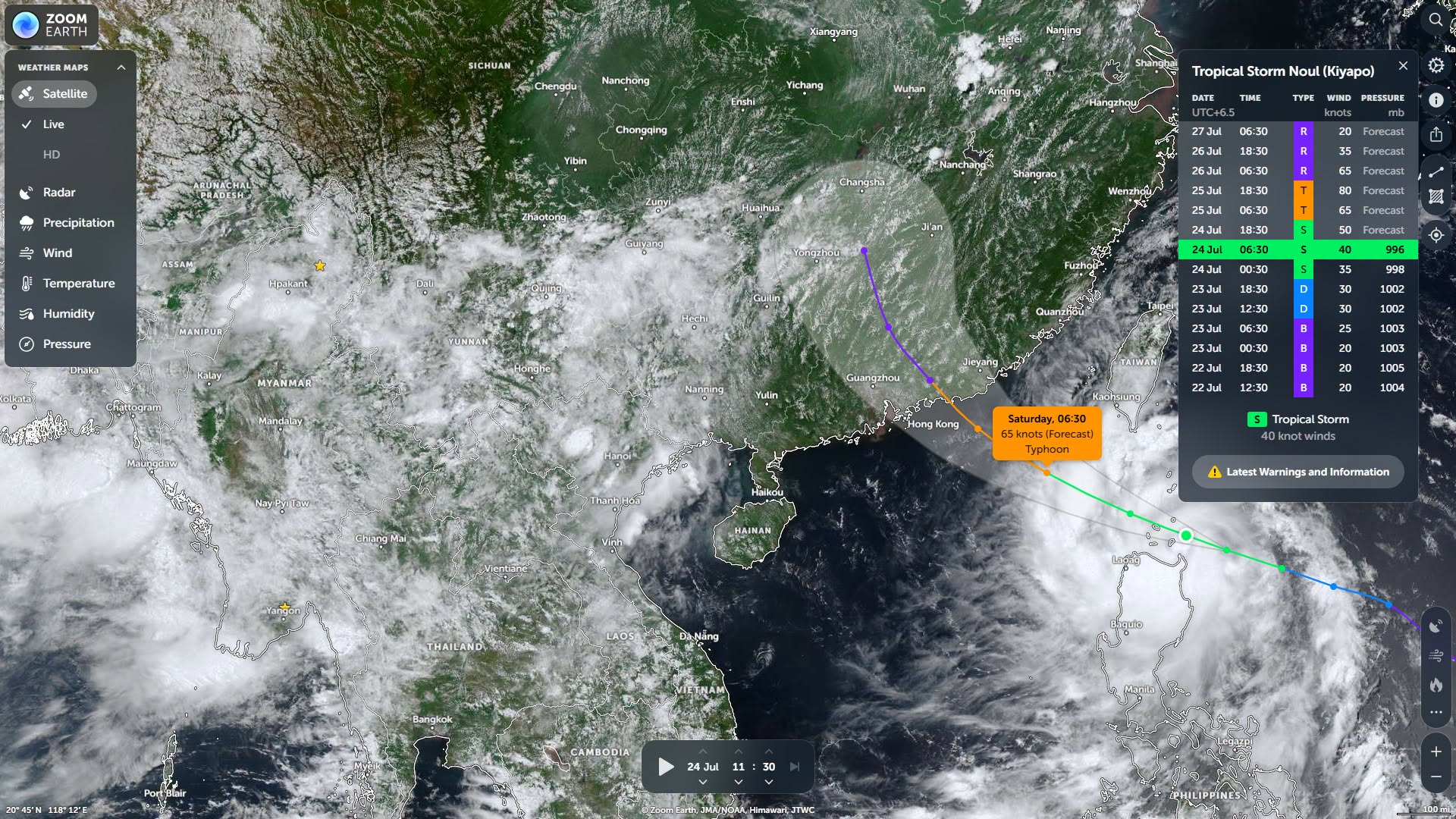
Due to the simultaneous occurrence of the pull from the eastern side of the typhoon in the South China Sea and the low pressure area in the northern Bay of Bengal, the southwest monsoon is expected to enter Myanmar with very strong force.
Meteorologist U Win Naing has forecast that in Rakhine State (northern part), Chin State, and Sagaing Region (upper part), which will be directly affected by the Bay of Bengal low pressure area, extremely heavy rain is possible from July 25 to 28.
In Ayeyarwady Region, Yangon Region, Bago Region, Mon State, Kayin State, and Tanintharyi Region, where the monsoon winds will directly blow, continuous rain is expected with localized heavy downpours.
In Magway Region, Mandalay Region, Naypyidaw, Sagaing Region (lower part), and Shan State, widespread rain is possible, and due to the formation of cumulonimbus clouds, strong winds may occur.
Although the South China Sea typhoon will not directly enter Myanmar, it will enhance the monsoon inflow. Meteorologist U Win Naing has forecast and analyzed that from July 25 to 28, rainfall across Myanmar will significantly increase.
MyoTaw News Channel
#myotawnpt
#Myotaw

 Weather News