
 Weather
Heavy Rain Expected in Naypyitaw and Central Regions Due to Storm Remnants
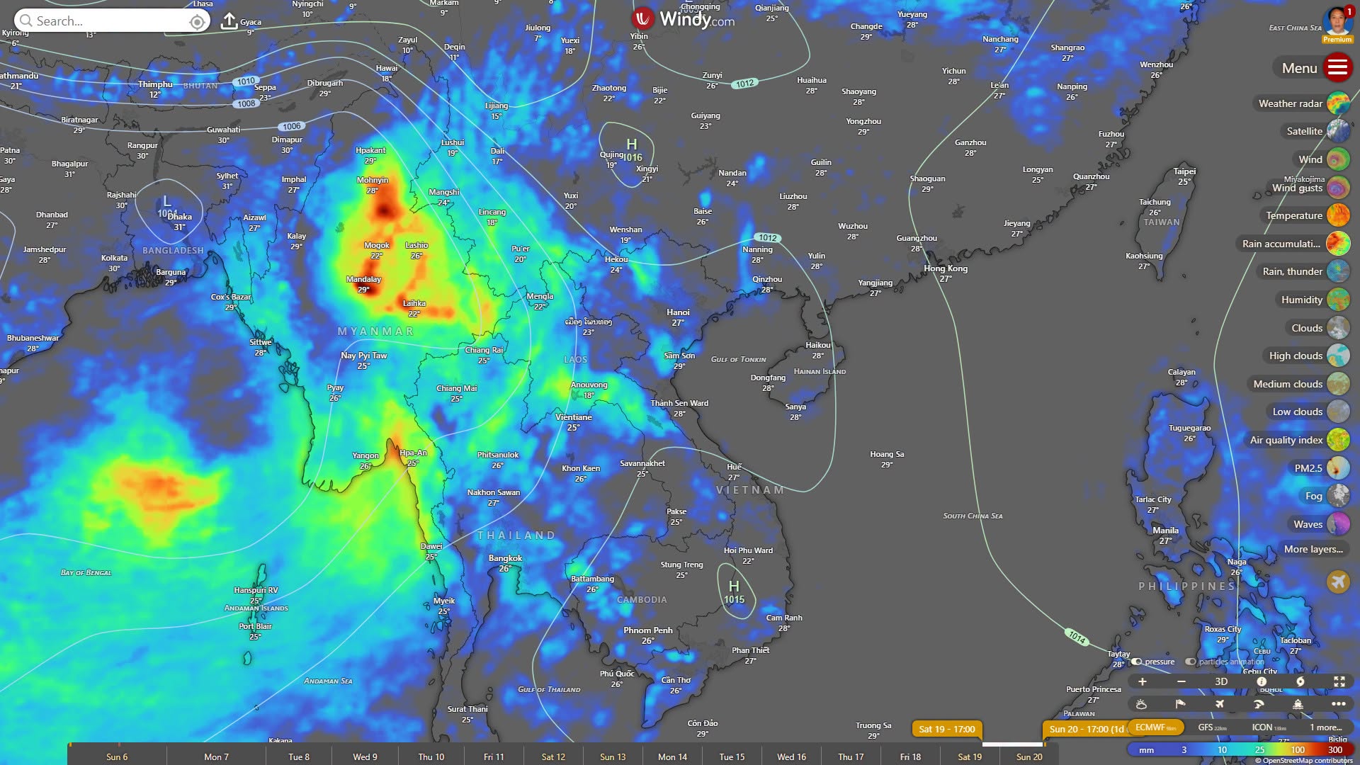
According to forecasts from three major models—ECMWF, GFS, and ICON—a low-pressure system is beginning…
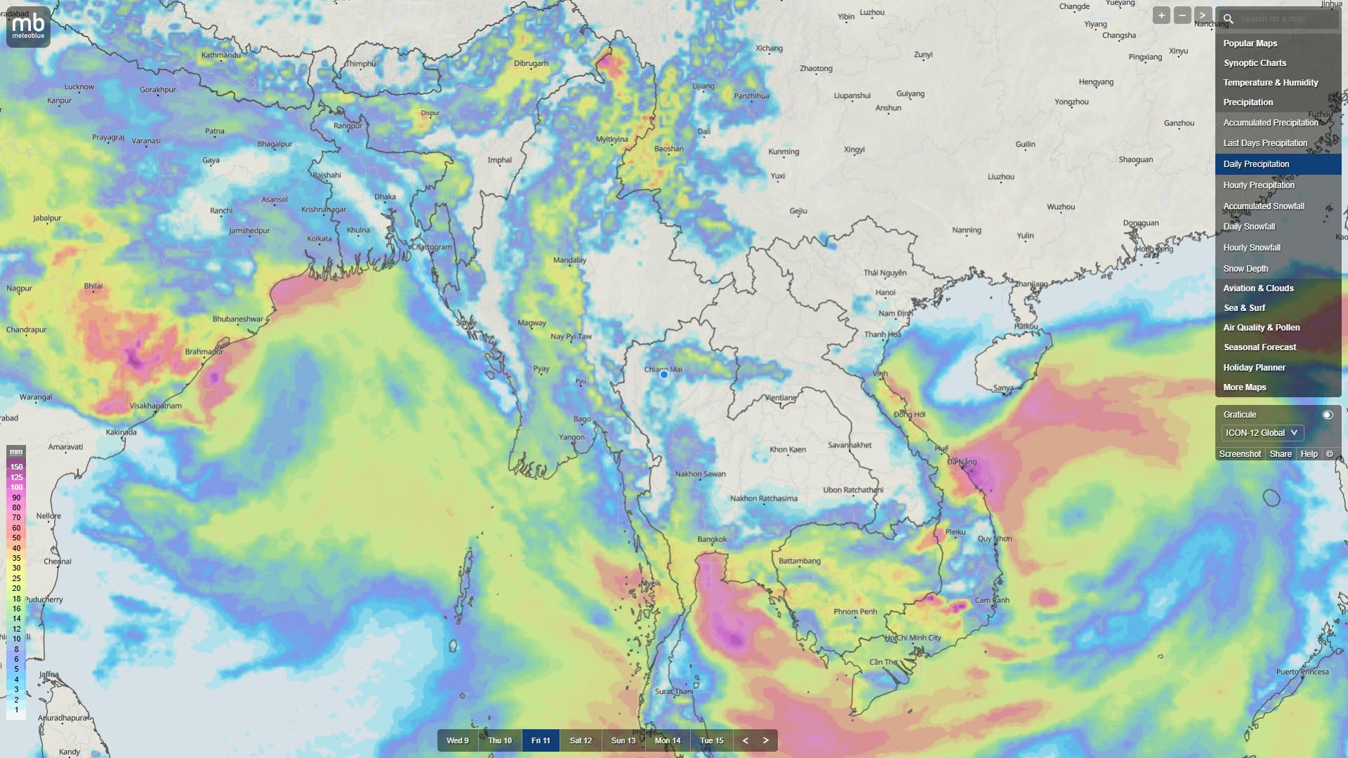
Some regions and states may see heavier rain due to the strength of a South China Sea storm
September 10
According to forecasts from the ICON Model, the Thai Meteorological Department, and the India Meteorological Department, the low-pressure wave forming in the northern Bay of Bengal may strengthen into a low-pressure area today, September 10, and although the system will be directed toward the offshore area of India, weather expert U Win Naing has assessed and predicted that moisture-rich rain clouds may enter northern and western regions of Myanmar.
From September 11 to 13, the low-pressure cell in the central part of the South China Sea will strengthen further into a tropical storm, and that storm is expected to move toward and reach the northern coastal area of Vietnam between September 14 and 15, it is said.
From September 14 to 15, due to the strength of the South China Sea storm, the southwest monsoon winds blowing across the Andaman Sea and the Gulf of Mottama will become more intense and stronger, and rainfall in Tanintharyi Region, Mon State, Kayin State, Bago Region, and Ayeyarwady Region will significantly rise again, it is said.
Because the monsoon will become intensely strong in Tanintharyi Region, Mon State, and Kayin State, from September 14 to 15, conditions may go from scattered heavy rain to extremely heavy rain, it is said.
In Bago Region (southern/eastern/western), Yangon Region, and Ayeyarwady Region, from September 10 to 14, due to the monsoon trough descending and the monsoon strengthening, rainfall will continue persistently, it is said. In the eastern foothill areas of the Bago Yoma and low-lying areas including the Ayeyarwady River basin and Ngawun River basin, the current flooding situation will not decline rapidly yet, and the receding of water will remain more delayed, it is said.
In Sagaing Region (upper/lower), Kachin State, and Chin State, the monsoon trough will descend completely southward, and from September 11 to 13, rainfall will significantly decrease, it is said. Because rain will decrease in the upper reaches, the flow of water in the upper river will decline, and in the middle and lower parts of the Ayeyarwady River basin, river water levels may rise less or may even stop rising, it is said.
In Mandalay Region, Magway Region, Nay Pyi Taw, Shan State (northern/southern/eastern), and Kayah State, because of the central dry zone and eastern highland areas, within 7 days there will be only moderate cloud formation and rainfall will be less than in previous days, weather expert U Win Naing has assessed and predicted.
MyoTaw News Channel
Weather
According to forecasts from three major models—ECMWF, GFS, and ICON—a low-pressure system is beginning…
 Weather
A glacial lake outburst flood in the Himalayas struck Nepal and Tibet on August…
 Weather
In Ayeyarwady Region, Ye Kyi Township, the body of a young man who was…
 Video
Local News
Video
Local News
Daily evening news for September 15, 2026